Committed to protecting
our Community
and River Valley
Established to safeguard Bampton against the imapcts of flooding in the catchment, our group combines monitoring and measuring with resilience action planning. We strive to foster collaboration among residents, authorities, and landowners to reduce flood impact with transparency and trust.
Chair: Iain Williamson. Treasurer: Anne Farrow. Secretary: Douglas Weymouth

Join Us in our flood
resilience efforts
Engage with our consultations, access timely river data, and participate in initiatives that enhance our flood preparedness. Become part of a committed local network focused on protecting Bampton and its surroundings.

Bampton Flood Resilience Group
Background
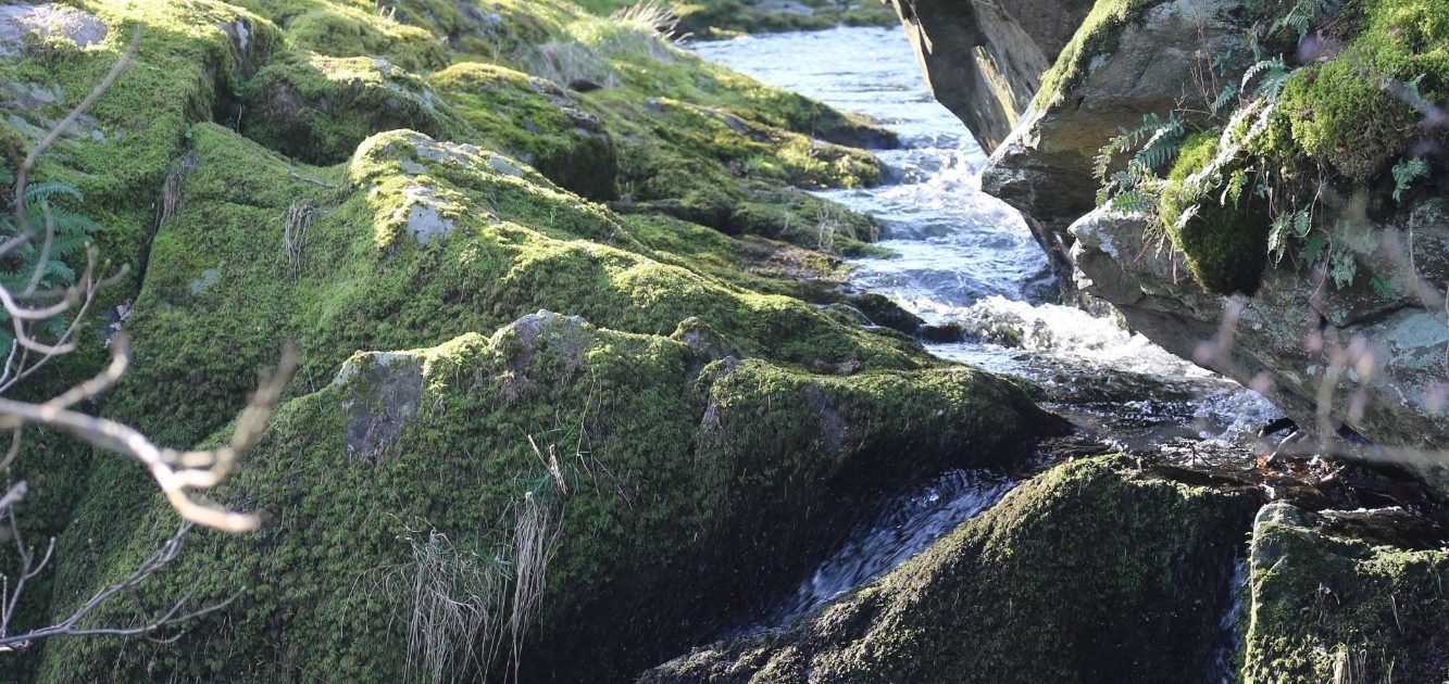
The River Lowther has a specific hydrological identity as a classic, "flashy" upland river that is heavily influenced by the geology of the Lake District but also by the management of many landowners and agencies in the valley.
The River Lowther is unique because its flow is "regulated" by upstream assets. The Lowther catchment is fundamentally controlled by Haweswater and Wet Sleddale reservoirs. This means local flooding isn't just about rain; it’s about how United Utilities manages reservoir spillways under Environment Agency regulations.
Despite the reservoirs, the surrounding fells (Cumbria High Fells) have thin soils and steep slopes, meaning rain reaches the river at Bampton, Bampton Grange and nearby settlements very quickly via a network and confluence of numerous tributaries. There is a near level 5km by 1km basin running from Bomby to Setterah Park.
Data from climate change models predicts there will be increased incidents of flash flooding in the valley affecting and potentially worsening access for the widespread community with greater risk to lower lying properties.
In a Landscape Recovery context, the Bampton Flood Resilience Group is representing a community in a "hotspot" for Natural Flood Management (NFM). There are rolling projects to "re-wiggle" tributaries and reconnect the rivers to their ancient course to reduce peak flows, most recently in applications made by agencies to Defra Landscape Recovery Schemes.
In the world of hydrology, Upstream vs. Downstream tension is real: a Landowner may want to implement a scheme that pays well but has unproven hydrological benefits whereas a Resident may oppose a scheme out of fear, even if the data shows it reduces flood risk. The Bampton Flood Resilience Group must therefore frame the conversation away from "personal opinion" to "disclosed perspective," based on facts which builds trust with the Environment Agency, DEFRA, United Utilities, The Lake District Planning Authority, Cumbria Connect and the residents and other interest groups.
Through 2025 a group of residents were facilitated through a series of informative meetings, discussions and presentations in Bampton Village Hall from representatives of Cumbria Connect, United Utilities, The Environment Agency and a local flood resilience officer. In January 2026 the Group met and determined to formalise themselves into an Unincorporated Association community interest group to further progress their understanding of the hydrology, flooding and resilience of the Lowther Catchment Area and to advocate for sustainable hydrological practices within Bampton parish on behalf of the resident and business community and visiting public. The following document is the Constitution setting out the governance, administration, field operations, health & safety and stakeholder engagement foundations for the Group including the names of the founding Members.
Our collaborating partners
Helping us achieve our aims
Working alongside is our County Council, The Environment Agency, United Utilities, Cumbria Connect, The Lake District National Park Authrotiy and our Parish Council

Our Constitution
1.1 The Constitution: Our legal framework is an Unincorporated Association community interest group. Our goal is to monitor, analyse, and advocate for sustainable hydrological practices within Bampton Parish and the River Lowther Catchment on behalf of the community.
1.2 Aims & Objectives: The primary aim of the Bampton Flood Resilience Group is to act as a community-led body dedicated to understanding, monitoring, and influencing the hydrological flows, health and flood resilience for natural water as it passes through various settlements in the River Lowther Catchment in response to existing management practices, climate change and evolving land-management practices.
To achieve this aim, the Group will actively engage in:
Evidence Gathering & Monitoring: Establish a baseline understanding of local hydrology by collecting and analysing existing and future data regarding water levels, flow rates, and soil saturation, particularly in relation to annual probability flood events.
Landscape Recovery Integration: Critically evaluate and engage with Agri-Environment Schemes (such as Environmental Land Management and Landscape Recovery pilots) to ensure that both man-made and "nature-based” solutions (e.g., leaky dams, highways, peatland restoration, or re-meandering) are hydrologically sound and do not inadvertently increase risk to local assets and, that these all essentially abide by the principle of "public money for public goods" ensuring taxpayer funds must be used to generate clear, measurable, and positive outcomes for society.
Climate Adaptation: Assess the projected impact of climate change on the local catchment, focusing on the increased frequency of "flashy" rainfall events and prolonged drought cycles.
Infrastructure Oversight: Review the effectiveness and maintenance of existing flood defence resilience measures, ensuring they remain fit for purpose under modernized climate modelling.
Stakeholder Liaison: Act as a central point of contact for the community to engage with the Environment Agency, Local Lead Flood Authorities (LLFA), Westmorland and Furness Council, LDNPA and regional farming clusters.
Knowledge Exchange: Foster community education regarding "Slow the Flow" techniques and sustainable drainage systems (SuDS) to empower residents in property-level resilience.
1.3 Conflict of Interest Policy: Maintaining integrity between the Group Members, Residents, Agencies and Landowners.
All members shall upon joining the Group and annually thereafter, declare any financial, professional, or personal interests that could be perceived to influence their contribution to the Group’s work. This includes, but is not limited to:
- Ownership of land within the River Lowther Catchment
- Employment by, or consultancy for, agricultural businesses or environmental NGOs.
- Active participation in government-funded schemes (e.g., ELMs, Landscape Recovery).
1.4 Register of Interests
The Secretary shall maintain a formal Register of Interests, see Appendix A which shall be made available to all Members. It is the responsibility of each Member to update the Secretary of any changes in their circumstances within 30 days.
1.5 Management of Conflicts during meetings: If a matter is discussed that directly affects the private interests of a member (or a close family member/business partner), that member must:
- Disclose: Declare the interest as soon as the item arises on the agenda.
- Withdraw: Recuse themselves from the decision-making process. They may participate in the technical discussion to provide expert context but must not vote on any formal resolution related to that specific interest.
2. Administration & Data Privacy
2.1 Membership Terms: Ideally there will be designated ‘responsibilities’ for each of the founding members. The Group can appoint and replace a Chair (for coordinating meetings and representing the group), a secretary (for notification and recording of meeting agendas and minutes), and a Treasurer (for managing funds). There will initially be no more than 10 members for an initial 12-month period after which Members may agree to increase or decrease the group size to a maximum of 12 or minimum of 4.
2.11 Decisions: will be by simple majority. A quorum of 4 including Chair being required minimum at meetings.
2.12 Scope: In the first year of its constitution the Group will limit its scope (as a minimum) to fact finding such as commissioning independent hydrological surveys; liaising with the Environment Agency or local Lead Local Flood Authorities (LLFA); Westmorland and Furness Council, liaising with and responding to planning applications or Agri-environment scheme proposals.
2.13 Financial Management: In the event the Group receives any grant funding this must be used solely for the group’s objectives requiring two signatures for any bank withdrawals or oversight of direct digital payments from a bank account.
2.2 Privacy Notice (GDPR) – see Appendix B: How we protect and store Member data by keeping appropriate records in the Master Folder for an agreed maximum period.
2.3 Communication Protocols/Key Contacts: Guidelines and template(s) for Group formal meetings and inter member communications. Members should preferably use a WhatsApp group chat and/or 10-member closed email mailing list alongside rthe monthly first Monday in the month meetings.